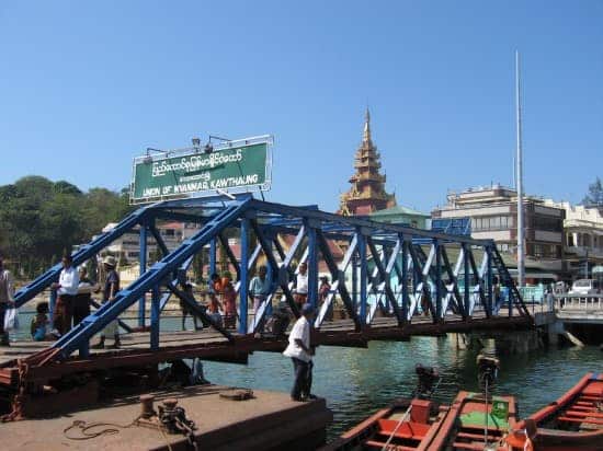
Kawthaung is a town located at the southernmost tip of Myanmar, right next to the Thai border. As the capital of Kawthaung District in the Tanintharyi Region, it is an important port town and trade hub.
Kawthaung has a long history of being part of various kingdoms and empires. With picturesque islands, pristine beaches, multicultural influences, and scenic landscapes, Kawthaung has emerged as an attractive tourist destination in recent years.
In this article, we will explore Kawthaung in detail, including its history, geography, climate, economy, transportation, tourism, culture, and local lifestyle.
History of Kawthaung
Ancient period
The original name of Kawthaung was Kongsee or Kongsay. Its strategic location on a narrow peninsula made it an important seaport for maritime trade since ancient times.
Archaeologists have found remnants of terra cotta tablets and stone inscriptions in the area belonging to the 4th to 9th century when the Dvaravati kingdom of the Mon people ruled the region.
Under regional powers
In the following centuries, Kawthaung came under the control of various Mon kingdoms as well as the Khmer Empire centered in present-day Cambodia.
From the 14th to 18th centuries, Kawthaung was part of the Ayutthaya Kingdom and later the Rattanakosin Kingdom of Siam (present-day Thailand). The Siamese called it Kongsae.
Burmese conquest
When the Konbaung Dynasty rose to power in Myanmar in 1752, King Alaungpaya conquered the Tanintharyi coast in 1765, putting the region under Burmese control. This marked the inclusion of Kawthaung into the territories of the Burma kingdom.
British Rule
The British defeated Burma and gained control of Tanintharyi and Kawthaung in 1826 after the First Anglo-Burmese War. The city was now called Victoria Point by the British. Kawthaung briefly came back under Burmese rule for a few months in 1852 before being recaptured by the British in 1853.
World War II Occupation
During World War II, Japanese forces occupied Kawthaung in 1942, along with most of Southeast Asia. But their rule was short-lived as the Allied forces regained the town in 1945.
Post-independence
After Myanmar gained independence from British rule in 1948, Kawthaung became part of the southernmost Tanintharyi division of the country. In 1989, Tanintharyi was split into the Tanintharyi Region, with Myeik as the capital and Kawthaung becoming part of it.
Naming History
The city has been known by various names in its long history – Kongsee, Kongsay, Kongsae, Victoria Point, and now Kawthaung, which means “mouth of the cave.”
Geography and Climate
Location
Geographically, Kawthaung is located at the southernmost tip of the long and narrow Tanintharyi peninsula. It lies right next to the Thai border, facing the Andaman Sea to the west. The coordinates are 10°00′N 98°33′E.
Nearby cities
Kawthaung is quite far from other major cities in Myanmar. It is located about 615 km south of the capital, Nay Pyi Taw, and 685 km southwest of the biggest city Yangon.
Landscape
The town is surrounded by hills and mountains that are part of the Tenasserim Range on its eastern side. The coastline is indented by many small bays and coves. Numerous islands lie off the shores of Kawthaung.
Nearby islands
Some of the islands near Kawthaung are Kadan Kyun (5 km from the mainland), 115 Island, Bird Island, False Island, and Victoria Point Island. Further south lie the bigger islands of Kawthaung District – Lampi, Stewart, Ellis, and Bluff islands.
Climate
Kawthaung has a tropical monsoon climate. It is hot and humid throughout the year. Temperatures range from 23°C to 36°C. April is the hottest month. The rainy season is from May to October, with the maximum rainfall in July and August.
Economy and Transportation
Economy
Kawthaung’s economy relies heavily on its seaport, fishing industry, and cross-border trade with Thailand across the narrow estuary. It exports marine products, wood, antiques, and rubber. Imports include petroleum, consumer goods, raw industrial goods, and food items.
Border trade
There is a high volume of border trade with Thailand facilitated by frequent boat services between Kawthaung and the port town of Ranong, just 30 km across the Pak Chan River estuary in Thailand.
Air transport
Within Myanmar, Kawthaung is connected by air through the Kawthaung Airport, located to the northeast of town. It has regular flights to Yangon and Myeik.
Road transport
Overland transportation from Kawthaung to other parts of the Tanintharyi Region is via the Tanintharyi Highway and smaller roads passing through the Tenasserim hills. Pickup trucks and buses provide transport, but the road conditions are poor in some patches.
Seaport
The seaport and fishing harbor of Kawthaung serves cargo ships, small boats, and fishing vessels from Myanmar and neighboring countries like Thailand and India.
Tourism in Kawthaung
Attractions
The main attractions drawing tourists to Kawthaung are its beaches, islands, variety of watersports, and cultural landmarks.
Beaches
Some nice beaches include Grandfather Beach and Paradise Beach, located north of town with clear blue waters, picturesque sunsets, and beachfront restaurants.
Other beaches like Bayintnaung Beach, Independence Beach, and Victoria Point Beach near the port also offer swimming and beachside relaxation.
Islands
The islands near Kawthaung provide great getaways for picnics, snorkeling, and beach activities like swimming, jet skiing, and banana boat rides. Some notable ones are 115 Island, Bird Island, False Island, Coco Island, Kegon Island, and Kadan Island.
Watersports
The coral reefs and clear waters make Kawthaung ideal for snorkeling and scuba diving. Other watersports like kayaking, boating, and fishing trips can also be enjoyed.
Trekking and rock climbing
For adventurous tourists, Kawthaung provides opportunities for rock climbing and trekking in the forested hills nearby. One can witness exotic flora and fauna along the trekking trails.
Cultural attractions
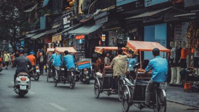
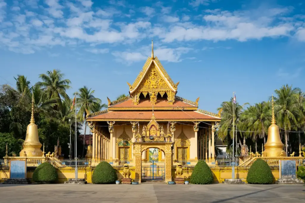
In the town itself, one can see various Burmese Buddhist monasteries, Chinese temples, old mosques, and Catholic and Protestant churches representing its diverse cultural influences. Some colonial-era buildings can also be seen in the city center. The markets offer insights into local life.
People and Culture
Demographics
Kawthaung has an ethnically diverse population consisting predominantly of Bamar (Burmese), along with Karen, Thai, Chinese, Indian, Malay, and small minorities of Sea Gypsy, Dawei, and other ethnicities.
Religion
Most people follow Theravada Buddhism, but there is a significant Muslim minority of mixed ancestry in Kawthaung. One can also find followers of Hinduism, Christianity, Animism, and Chinese folk religion.
Burmese culture
Burmese culture is seen through Buddhist monasteries, pagodas, a celebration of Burmese festivals like the Thadingyut lighting festival, the Thingyan New Year water festival, and the Tazaungdaing festival of robes offerings to monks.
Multiculturalism
Its proximity to Thailand means Thai culture has also influenced local art, language, cuisine, and performing arts alongside Burmese culture. The mix of ethnic groups adds to the cultural melting pot seen in Kawthaung.
Cuisine
Food here has diverse cultural influences – from Burmese curries, noodles, and salads to Malay, Thai, and Chinese-inspired dishes. Being a coastal town, seafood is very popular and features in local cuisine.
Conclusion
Kawthaung offers visitors much more than just being a border town and trade hub. With alluring islands, pristine beaches along the Andaman Sea, tropical weather, adventure sports, Buddhist sites, multi-ethnic culture, and vivacious markets, Kawthaung provides an offbeat destination for those seeking to go beyond the regular tourist circuit in Myanmar.
The town’s fascinating history, melange of cultures, and natural beauty make it worth a visit. As infrastructure and tourism services continue improving, Kawthaung is sure to emerge as a highlight of the Tanintharyi Region for both local and international travelers.
